Showing posts with label hiking. Show all posts

Saturday, May 16, 2009

Something to Read

Okay,
So some people have been complaining to me lately about the fact that I haven't updated my blog in some time. Little more than 3 months to be exact I suppose. So here's a post. Stop complaining.

Since I don't really have anything to talk about, I guess I'll just write about what has happened Since February. The short if it is, not a whole lot. People outside of our nuclear family (including extended family and friends) have been living with us up until a few weeks ago. It was both stressful and fun at the same time.

I have completed all my 'PM' (Prospective Member) Training with the Alpine Rescue Team and have moved on to 'PM' status. Yes, its the same... just stands for "Probationary Member" now. Basically that means I have to go to 50% of all trainings and make 25% of all calls (they refer to them as missions) between now and October when I get officially voted in, or kicked out.

Work is Work. 'nuff said.

Yesterday we took a hike where I did my overnight Bivy for the Alpine Team. I saw a waterfall in the distance so I figured it would be a fun easy hike for the family. Enjoy the pics.


Tuesday, December 30, 2008

The Element of Snow

Yesterday probably ranks in as one of the hardest hikes I've ever done... Sadly. Some friends and I decided to go make an attempt on Mt. Sherman from the fourmile creek road. Snow drifts had covered parts of the road that caused us to stop short of the trail head by vehicle. GPS readings showed that we started at about 10,500 in elevation.
As always, I was well prepared for anything. I had my medical kit, big enough to treat a small mass casualty incident. My tent fly, poles, and ground pad, for a quick shelter should it be necessary, also included lots of utility cord to tie the thing down, as I was expecting high winds in the afternoon. I also had a complete change of clothes for all 3 layers I was wearing. On top of that, 4 liters of water, and my camp stove, fuel, and a pot to melt snow for water if we needed it. I probably had enough food to last 2-3 days as well. Add the snow shoes in to the mix when on my back, and my pack weighed in at 40 pounds. Why do I always do that to myself? I need to stop. 40 pounds for a day hike is ridiculous, even if you are preparing for the worst. My 5 year old son weighs less than that!
Anyway, we found a place to park after getting the Jeep un-stuck from a snow drift in the road, I put on my Gaiters, wool sweater, balaclava, and coat. Threw the pack on my back, and we headed up the road to the trail. It wasn't long till we figured out we did the right thing by parking where we did. I was soon post holing in the snow to mid calf. The Jeep would have never of made it through (at least not without a lift kit, and some much larger tires). After about 1/2 mile of pushing through this stuff, we got the bright idea of actually using the snow shoes we brought. I was getting really hot, sweating and beginning to feel my inner layers get a little damp. so it also seemed like a good time to shed all those layers I put on back at the jeep (sweating in cold weather is very dangerous, and can eventually cause hypothermia when you stop moving). The snow shoes made the going a lot better. However, after about another 3/4 of a mile, the road/trail became windblown and not much snow lay on it. Instead of taking off the snow shoes, we hiked uphill in the ditches, where some snow remained. Eventually we took a break and took of our snow shoes, for the remainder of the hike up. There were only a few areas that were deep with snow, that didn't warrant the time and effort it would take to put the shoes on and off again. Through all of that, I learned that snow bails would have been great to have for my trekking poles, as without them, they didn't provide a whole lot of support. Fortunately, the snow wasn't super deep, and extending them beyond my normal length seemed to do okay.

After about 4 hours of hiking, we made it here, to one of the old mining shacks, situated right around 13,000 feet. You can see the peak of Mt. Sherman in the background. I was finished. Every step forward/up with my pack yielded a wonderful burning sensation in just about every muscle in my legs. My back and shoulders were tired from carrying the load. The altitude had gotten to me. It wasn't that I was out of breath, but more that my body just couldn't get the oxygen it needed to my muscles, putting them in anaerobic respiration, for every step. So we stopped at this old mining shack (above) and ate our lunch. The rest was good, the food enjoyed, and the company most excellent. Despite all the work and pain to get to this spot, it all goes away when you turn to enjoy where you are at. Having had no expectations to reach the top of the mountain, I was glad to be where I was.
We sat on a small wooden plank, with the wind at our backs (along with the building) and the sun on our faces. One of my hiking partners (John, though they were both named John) had mentioned that he thinks that this is what the light at the end of the tunnel is like. I have to agree, I don't think its far off. The sun shining on us in the cool weather certainly didn't help negate that feeling.

After lunch, we turned, and looked at the peak ahead of us (above), looked at trail options, and considered the time. We all agreed that heading down back to the Jeep was in our best interest. I repacked my pack, slung it around to my back, and we started to head down.

The view was great, and it was quite a relief to be going down. There were a few spots we contemplated doing some glissades, but decided not to. Oh well. Carried the ace axe all the way up and down for nothing, except maybe the feeling of safety that I had the tool should I actually need it (much like the rest of the stuff in my pack). We eventually made it back to the snowy section of the trail and stubbornly pushed through it for a ways without snow shoes again. Becoming quickly exhausted, we put the snow shoes back on and continued out to the Jeep. I don't remember this section seeming so long on the way in. It seemed to just keep going and going. The extra weight of the shoes on our legs made every moment harder, but it was still easier than post holing. With much relief and about 6 miles of total hiking round trip, we made it back to the car and headed home.
This trip was the first time I've ever had a pair of snow shoes on my feet. I have to say, its pretty neat to be able to walk on the snow like that. I had rented a pair from a local outdoor shop. I have to say I was impressed with how easy they were to put on, especially compared to the brand my hiking friends had. Mine were made by Atlas and I would have to say if I were going to buy some, I'd probably get a set of these, after this experience. They seem to be on the pricey side, but I really liked how they worked. They fit well with my boots, were a snap to put on and take off, and seemed to support my weight, including my 40 pound pack, above the snow. Now all I need to do is keep up the exercise so that I can do this kind of thing again, and not feel so bad afterward. I suppose getting up in altitude to keep my body adjusted to it would help too.
On a side note, I have an interview with the alpine search and rescue this coming sunday, if I make it past that step, I'm sure they'll give me the opportunity to spend more time in the mountains :)

Sunday, November 02, 2008

Feeling Inspired

I don't have a whole lot to report.  Well, maybe I do, the more I think about it.  Got a promotion at work last week.  Not bad almost exactly a year to date at this new job, and things are working out well.  I enjoy the people I work with the most.  Doing Federal Government work certainly has its drawbacks, but there's a lot to be said about working with a bunch of intelligent people.  That was the hardest part about leaving my previous job, and really the only thing I miss from it.  That's likely to be the hardest thing about this job, should that day come.  Going to Antarctica on occasion is pretty sweet too, I must admit.  Though, if Geoffrey were older, I would seriously consider spending a season down there, especially if I could get Jess a job there too.

So I've now officially been in Colorado for a year now.  We arrived a year ago, to the day.  Looking back, I'm glad we made the decision to come out.  This place is everything I've thought it could be, and more.  Probably the biggest part of my life that I left back in Pennsylvania was the Fire Department and the Urban Search and Rescue Team.  I had a lot of time and energy invested in that, and I miss the service.  Much of the Volunteer fire companies around here involve a serious time commitment, which usually involves staffing the station.  Something I just don't want to commit to around here, especially living so far away from a station.  The area that I live in now is staffed by a career department.  With that in mind, I have begun looking elsewhere, locally to apply some of the knowledge I've gained.  I ran across the Alpine Rescue Team.  It's something I've wanted to become a member of, but wasn't sure if I could until I moved more into the "mountains."  After visiting one of their training session, it seems like it may be more of a possibility than I thought.  Only problem is they seem to have the opposite problem facing most volunteer companies in Pennsylvania; too much interest.  As a way to combat that, they only open up to new members once every 2 years, and from the 30+ applicants, select 8-12 people.  Everyone gets interviewed, and then you go through a "training course."  I look forward to it, should I be accepted.

On a somewhat "Alpine" related topic, tomorrow and Tuesday are the final days of the Altitude Mountain Sickness study I am involved in.  Talking with the staff there, I found out that I'll be locked in the chamber with Climber and Mountaineer Pete Takeda.  I will admit that before I found out about this, I didn't really know who they guy was.  I recall the name vaguely, probably from articles I've read here and there.  Well, as you can see from his website, he's well published, and his most recent has one some awards.  I figured since I was going to spend 12+ hours in a small chamber with him, I'd read his book and have something to talk about with him.  

As far as the book goes, I'd give it two thumbs up.  I don't read much, especially "stories," fiction or non.  Most of the stuff I read are often technical books related to the computing industry.  This book has inspired me to do otherwise.  I truly enjoyed it.  So much so that I went out and bought another(similar) book at the bookstore tonight.  The reviews of Mr. Takeda's book, An Eye at the Top of the world, are accurate.  It is well written, and keeps you locked into his story. It's hard to believe that the people went as far as placing nuclear powered device on top of some of the worlds tallest mountains.  Maybe its hindsight, but it just doesn't seem to intelligent to me.   After reading his story, I look forward to spending some time with him, though I'm not certain its anything he may enjoy talking about, we'll see.  The story has really inspired me to want to peruse some more technical mountaineering skills though.  Its just a matter of finding people to go with, as its certainly not something to do alone.  Also involves a little more gear acquisition too.

Sunday, October 05, 2008

AspenGlow

So we took a trip up to Rocky Mountain National Park again this weekend. The leaves are beginning to turn down here in the front range, so I figured that a lot of leaves up at higher elevation must be getting close to peak. I had this planned for at least a week and was quite excited to get back up in the mountains. I've been limited to 7000 foot maximum elevation due to the clinical study I am in. Last Friday was my last session until next year, so I could get to higher elevations now. Of course since I had this planned, the weather forecast wasn't all the great. It was supposed to rain late in the day, with accumulating snow at night in the high country. I decided I wanted to go anyway. I'd just have to pay attention to the cloud activity.

We arrived at the park around 10:30 AM. I had chosen a trial to hike on the western side, since I've been in Colorado now for almost a year and was yet to make it over the continental divide. (Crazy huh?) Well, trail ridge road, and old fall river road were both open. I was in luck. These roads usually close down sometime in October because the road conditions become so bad. I don't blame them The road up is pretty steep and twisty turney. I can see why the close it down. Old Fall River road is dirt, and unidirectional (up only). My wife made the comment that she never intends of driving up that road. I thought it was great. There were several areas that were quite narrow with a significant exposure (drop off) down the side of the mountain, without any kind of barrier preventing you from going over. Anyhow, below is one of the views from Old Fall River road, of the valley. It was pretty much at the base of road, not very high up.
Also, before we started to ascend the road up over the divide, we made a quick "nature break" While my son was doing his thing in the privy, a couple of other photogs (with mighty big lenses and tripods, I must add) spotted this little squirrel gnawing away on a bunch of pine cones. I guess it was fattening itself up for the winter. I pulled out my camera with my measly lens (yes, I had lens envy) and managed to snap this shot. Not to bad for being extended out to 300mm and hand held with no image stabilization, if I do say so myself.

We finally got to the trail head around noon, ate lunch in the car, then headed off up the trail. It was 4.4 miles to the ultimate destination (a lake). I knew this late in the day, we would never make it, but it would be nice just to get out anyway. Below is a picture of a small stand of Aspen that has turned for the season. This picture doesn't really do these trees any justice. They seem to range from an orangy red color all the way to an amazingly vibrant yellow. Almost as if they were luminescent, generating their own light. Several times, walking through the forest, you would spot some aspen through the trees, and they were so vibrant, it was almost as if a ray of sunshine was shining right down on them, even though the sky was overcast.

A little further down the trail, we came across a nice stream. Of course, Geoffrey had to play in the rocks and in the water, etc. He seems to like getting his picture taken, as long as its on his terms.

One of the good things about overcast days in the forest, is you can stop down your lens and get a decently long exposure without having to add filters. I always enjoy taking pictures of water and trying to get that nice flowy, fluid look. I was pretty happy with this shot.

About halfway up the trail, I spoted some mountains in the distance that I was able to see earlier. I always like to track terrain in the distance to use as a reference for my location. The cloud deck dropping down on them. Not a good sign when you want to stay dry. So we turned around and headed back down the trail towards our car. Along the way we spotted this Elk cow grazing on some vegetation. She wasn't to really willing to move, but after slowly approaching here and making some noise she moved for us.

Turns out where she moved to, was with the rest of her harem, protected by this here bull. It was kind of cool the way he followed up through the trees as we were hiking to make sure we weren't going to go after any of his property. That's one guy I would not want to tangle with.


As we were walking about it started to rain lightly, so we called it a day and drove home. It was nice to say that I've now seen water that flows to the pacific instead the Atlantic. In fact, that stream I took a picture of above, is part of the head waters that becomes the mighty Colorado River. Hope you enjoy the pictures. Don't forget you can always click on them to see bigger versions.

Wednesday, July 02, 2008

Catch Up

It sure seems like a long time since I've posted anything here, not quite a month. Mostly I've just been doing the same routine, work, eat, sleep, etc. Life is good. Parenting is difficult. Work is work. Nothing new really. I did however manage to go on a backpacking trip with a friend from Pennsylvania, and his friend. We spent 4 days and 3 nights hiking around Rocky Mountain National Park, the highlight of which was climbing Long's Peak, my first time above 14,000 feet in altitude.

The above Picture is Long's peak from Boulderfield campsite, the morning of our summit. You can see the weather was perfect. It's quite an amazing experience being up that high, and yes, I certainly could tell there is less oxygen up there... In fact mild symptoms of altitude sickness set in for me on the second day. I had a nagging headache that was there enough to make itself known, and by the time we came down off the peak, I had no desire to eat lunch. It was time to hike down to the next camp anyway, lower altitudes fixed all that.

Before the backpacking trip, the family and I drove up to Cheyenne, WY to check out the Sierra trading post brick and mortar store. Its pretty nice, prices are good, as always, but the selection lacked compared to the online offerings. On the drive up we saw our first wild Antelope playing in the fields, but alas, no roaming buffalo's Bison. The trip also reminded me that I'm not cut out to live anywhere between Denver and the Mississippi River. The plains just do nothing for me. I think I would go crazy without mountains, and at least some vegetation.

Cheyenne, itself wasn't all that exciting either... we drove around a little bit. I didn't see anything to exciting, and the place seemed kind of vacant. Some areas more well kept than others. Given my impression of Wyoming so far, its hard to believe that Yellowstone is in this state... but then again, you'd have the same impression, seeing eastern Colorado too.

So that's what's going on around here... Was feeling bad about not posting in a long while, and wanted to share the pics from my recent backpacking trip. Enjoy.

From RMNP Backpacking
"The Trough" It's steeper than it looks.

Tuesday, April 22, 2008

Kayland Vertigo High - usage report

Some kind person (Thanks Bill!) made an obvious point out to me about my previous review of the Kayland Vertigo High hiking boot. To be more specific, he was looking to find out more about how I felt the boot was supporting the foot. Especially for those who may be prone to rolling on ankle on loose or rocky terrain.

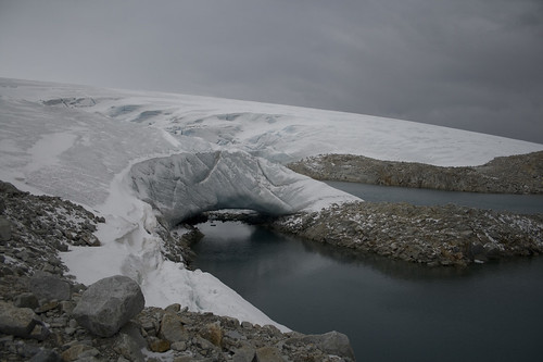
Well, For those of you who don't follow my blog, and happen to stumble upon it, strictly for the boot review, the nature of my employment recently took me on a trip to the antarctic peninsula, where I happen to bring my new boots with me. The terrain on my trip varied from roads on the streets of the city, to climbing over piles of rocks the size of soccer balls, to tramping up a glacier to see what I could see. Below is a picture where you can kind of see some of the terrain I was on... picture the rocks more varied in size, and looser.

The day I decided to take my climb up the glacier I managed to pick one of the windiest, wettest days there, but I wasn't going to loose the opportunity to hike up a glacier in Antarctica. The boots preformed very well.

I have found the lacing system to work very effectively. In fact, it worked so effectively that I have found that I actually can't tighten these boots like I was used to tightening my old ones. I ended up cutting off circulation to my feet. The tops of the boots come up over my ankle and I'm able to lace the shoes up to have a good snug grip on my whole foot and ankle, all while still providing enough movement to allow me to walk very comfortably. While I myself am not prone to rolling ankle injuries, I found myself on many an odd angle hiking around the "backyard" of Palmer Station. The boot preformed well.

During the weather I also pushed through mud, puddles and a rain/snow mix flying at me in 25-35 knot winds. The boots had excellent grip on the wet rocks. While you still have to be careful of foot placement in this terrain, I didn't feel I had to test every step with my weight. Going up the glacier I encountered hard ice, where I don't think anything short of Yak Traks or crampons would have helped. The boots slipped there, as I would expect them to. I also walked through sections that were there was hard ice but it had been weathered to have pea sized nubs and channels. Mild slippage here, but nothing a little caution wouldn't take care of. Yak Traks would still be preferable here. The glacier also had some loose wet snow where my foot would sink in an inch or three. No problem with traction there. There was one section where I started to post hole a little bit, up to just beyond the top of the boot. This caused my socks to get wet and soak water down into the boot. Had I had my gators with me, this wouldn't have been an issue. Even still, I think the boot did a good job keeping a majority of the water out. I had no problems going through water, nor did my feet ever get cold. Again, I'm very satisfied with these boots. They are still the most comfortable boot I've ever had, and I'd buy them again in a heart beat.

Sunday, March 16, 2008

Kayland Vertigo High Review

So I have to laugh... Within minutes of posting my previous post, I noticed I had a hit for someone looking for a review on the boots I bought. I figured why hold out for anyone looking. I'll go take a picture of my boots and start my review.

Note this is an initial review, and not totally exhaustive since I have only had them for a few weeks.

First, I suppose I should explain a little about myself and background, so you know what angle this review is coming from.

Age: 29
Height: 5'11"
Weight: 145 lbs
Shoe size: 10.5 US

Backpacking Background:
I've spent most of my life playing outdoors, in various sports activities, namely cross-country running and track and field throughout high school. As a child I would go and spend vacations with my Dad up in the Adirondacks in New York state, where we would climb mountains and just have fun. In college, I was a member of the outdoors club and went on various hikes with that group, and began going on more difficult hikes into the high peaks region of the Adirondacks. I've done numerous hikes along the Appalachian trail in Pennsylvania and Virginia, as well as a trip to the everglades, and swamps of Georgia. I consider myself a midweight backpacker. When I go backpacking my pack usually weighs between 30 and 40 pounds for hikes up to about a week in length. When with the right group, or by myself, I hike at a moderate pace of 2-4 mph, depending on terrain.

Product Info:
Manufacturer: Kayland
Model: Passage Vertigo High
Year of manufacture: 2008
Shoe Size: 10.5 USA
Color: Havana
URL: www.kayland.com
Listed Weight: 710 grams ea. (1.5 lbs.)
Weight as delivered: 3.2 pounds for the pair
MSRP: Not listed on web site

Product Description (from website):
This versatile boot delivers outstanding comfort, traction, and stability, scrambling off-trail, or traipsing through mud and snow. Of 110 different models tested, the Vertigo High was awarded the Backpacker Editors’ Choice Award for 2007.
  • Enhanced Rocker
  • Extended Lacing (laces go all the way to the toe)
  • Integrated Absorbing Drive System (IADS) pro
  • Level of rigidity: 5 (out of what?)
  • Sole: Vibram® Tsavo.

Initial Report:
These were the first pair of boots I tried on during my quest to find new hiking boots. My previous pair were EMS brand boots that were gore-tex lined, with a solid full leather upper. After years of wear, the soles had separated from the shoe and were just breaking down. I tried on about 8 different pairs of shoes at 2 different stores, and I came back to these ones. I could tell right away when I put these on, that I'd probably come back to them. Most boots I try on, I tend to find the toe box constricting, and the heel often feels to loose. I find such a fit tends to yield blisters on my heel and big toes. Once I put the Kayland on, my heels felt well supported and adequately confined in such a way that the boot would stay with my heel and little rubbing would occur. The shape seems to be designed around the shape of my foot. I was able to get a good snug fit with the lacing system without feeling like I was cutting off the circulation to my toes. I still had plenty of bend / wiggle room for my toes as well without feeling overly roomy. With a quick walk around the stores, the boot seemed a bit stiffer than what I was used to in a boot, even being brand new. This is actually what I was looking for though. Having just moved to Colorado, I wanted something to provide a little more support for the varied terrain I would be encountering during my attempts to begin summiting the 14ers.

The footbeds that come with the boot seem to be thicker, and potentially more durable than I've seen in other boots as well. The heel section has a black waffle type material on them, topped with a white felt/foam material thats maybe 1/8 inch thick, and the final interface on top being what seems to be an orange leather/suede type material.


Instead of Gore-tex, the Vertigo High's use Event technology to provide water proofing beyond the treated leather. Since its still mostly winter, I can't say how well this stuff lets sweat out of the boot, and keeps water from getting in. My feet do sweat a fair amount when hiking, and no matter what, my feet are usually just slightly damp when removing shoes, despite the activity. Results are no different with these boots thus far. I've hiked through shallow mud and water with them and have no complaints with the water repellency. The tongue is gusseted to the sides of the boot up to the top of the laces where the metal eyes are.

The toe of boot has a rubberized fabric that seems to be glued to the upper. It seems durable and should provide good protection against abrasion around the areas that typically get the most abuse.

As I mentioned previously, the lacing system extends down to the toe and allows me to get even tension across the whole of my foot. When tightening the laces, they don't relax much when you let go of the laces, this is nice as you don't have to keep constant tension on them when tying things up. The lace hooks seem to be well designed are are made of metal. My previous boots hooks stuck out a bit, and I would sometime catch the loops of my laces on the opposite foot when walking, these seem to be designed in a way that this shouldn't happen.

On their first few hikes outdoors, they've seen conditions from dry, loose dirt, to hard packed dirt. Rocks, and grass. Fresh fallen Snow all the way to hard packed snow and ice. The vibram sole seems to grip well when climbing largish rocks, even wet. The are doing well in all the terrain. I'm enjoying the stiffness of these soles, and the uppers are breaking in nice. No blisters, or even hot spots to date. I've done a few 4-6 miles hikes with them.

Overall, my general impressions of this boot is that it is extremely well made, with strong stitching and sturdy construction. I feel like the designers really took into consideration the structure of the foot (at least those similar to mine) when engineering this boot. Its truly a joy to hike in them. I feel like they return a good portion of the energy of my stride and help propel me forward. I look forward to many years of adventure with this boot. I recommend that anyone looking for a serious boot to get them where they need to go, consider this one.

Should you have any questions about these, just post a comment, and I'll do my best to reply in a timely manner.

Sunday, January 27, 2008

The last mile

Yesterday, My family and I went for a hike. Jess wanted to go somewhere where there were trees, and I wanted to find some place fun and new to hike... Through various searches, I stumbled across the Beaver Brook Trail. I had a hard time finding actual directions on how to get to a trail head for this thing. The description gave several generalizations as to popular access points, but that's about it. "It's near the Lookout Mountain Nature Center" was about the most useful information I found. I found directions to the nature center, and we drove there. Found a trail head, though not for the Beaver Brook Trail. Fortunately, there was a map of the area at that trail head that gave us a good sense of where we where, and where we needed to be. After driving around for a while, and asking a group of cyclists where Windy Saddle was (the supposed trail head to the trail that led to the trail ;). Anywho, all the driving around led us to a curvy windy road that goes up (and down) the side of Lookout mountain. I thought to myself, "I gotta ride my bike up this thing sometime, it looks like fun!"

So we commenced on our hike, and had a lot of fun. About 3 miles total in distance was hiked. I was surprised, some of the descriptions of this trail that I found said it was really poplular, so I figured it shouldn't be too challening... I guess in the summer time it might not be. Much of the trail this time of year still had plenty of snow on it, and the foot traffic had trampled the snow into some icy patches here and there. To top that off, the exposure of the trail was quite intimidating at times. One slip on the wrong spot and you're going for a ride! I don't suspect that the landing at the bottom is too soft either. Anyway, below are a few of my favorite photos. You can view the whole album here. I think my photo taking is getting a little better, but it still has a long way to go. I also bought a nice circular polarizing filter a while ago, and I keep forgetting to use the darn thing!


I thought this rock looked pretty cool. Kinda looks like there's a skull from some animal on top.


I was trying to be creative here... Not sure I succeed all that well. It looked better in real life I think. This might be another case where messing around with HDR imaging would come in handy. I really need a tripod before I can really make my attempts worth while though.

So anyway, on with the title of this post... The weather today was/is absolutely wonderful, crystal clear skies and 60+ degrees. I thought to myself, "self, why don't you go bike up that road you found yesterday." So that's what I did, and it felt great. I mapped out a route to get over to hill, made a course using the course creator developed by Brad Culberson, and uploaded it to my Garmin 305 GPS / bike computer. Sadly, I couldn't get my heart rate strap, or cadence sensor working. I think the batteries finally bit the dust in them. Oh well. That wasn't going to stop me from enjoying my ride.

I managed to navigate my way through Golden, avoiding most of the really busy roads, though, I also managed to go down a road that was gated at one end. Always fun to hop a fence in roadie shoes as cars and other bikers whiz by. Oh well. After a ten mile warm-up I made it to the base of the hill. I decided I was just going to go up at a pace I could handle, and knew I could sustain for a long time. Since the ride was new to me, I wasn't sure what kind of exertion I could put into it.

There were a ton of cars at the base, all with bike racks. We had seen a lot of riders yesterday while driving, and I think there were even more today. I managed to catch a couple people and pass them on my way up, but some managed to catch and pass me too. Unfortunately, I think more people passed me, than I passed. It was really tough to not hop on the wheel of others as they passed. Was probably a good thing though, I'm convinced that a bunch of people where at least semi-pro, or at least on some organized team of some sort. A couple groups had coaches talking to them out a car, etc. They probably woulda pushed harder just to drop me. I made it to the top, and took a 10 minute breather up at Buffalo Bill's grave.

At my rest, I had the chance to eat a Chocolate flavored PowerGel energy snack. All I have to say, is that if you really, really (and I mean really) like chocolate frosting, you just might be able to handle this stuff. The consistancy is that of a smooth creamy frosting, and the taste is quite chocolaty. It was just too much for me. I felt like all the sweet taste buds on my mouth where hyper stimulated. It took me most of the 10 minute break to choke the stuff down. All I had for a chaser was some Lemon / Lime Gatorade Endurance mix... Yack! The the Gatorade itself I thought was pretty good. Good flavor, not too sweet, and tart enough to keep the thirst working. The pouch I had made a quart, which I found kind of annoying, since my water bottles where 24 oz (as are most bike bottles).

At any rate, I made the wonderful decent back down the mountain feeling great about the climb. Good thing I brought arm warmers with me. I would have gotten cold without them. I haven't ridden since last November, not even on my trainer (I know, I've been bad), and here I was able to climb this thing. I thought I was crazy at the start of my ride, but I did it! Then it hit me... almost home.... Please, please remind me again why I decided to live in house at the top of no small hill, especially after what I had just been through. It was torture! I kept thinking to myself "how am I supposed to have a propper cool down when I have to go up this thing at the end of every ride? arrg" I sucked it up and finished, but not strong. Oh well.

Motionbased Stats are here.

It was a neat ride. Will certainly do it again. Great views, and I got to see some other people enjoying their hobbies. On some of the sharp turns on the climb up (switchbacks), I saw a group of people playing with remote control gliders, riding the wind currents coming up the mountain. I also had a paraglider person swoop over my head as well. That was cool.

Sunday, December 09, 2007

Heavy Air?

So I figured that I would take some pictures from the open space park that is very close to where I live. The clouds where cooperating, as they often do around here. Interestingly enough though, the air wasn't.


If you look close at the picture above (you might have to click on it to see it in detail), the city of Denver is actually in that picture. That big gray line going across the screen isn't the horizon you are seeing, well I guess it is. I'm pretty sure the lack of clarity is caused by smog. On warmer days it looks better. I've noticed this view on other cold days like today too. Its like the mountains trap that stuff down there, and it has no where to go. Makes me glad I live about 1000' higher, thats fur sure. Though I may be in it too, just don't notice whats in my immediate area. Doing almost a 180 degree turn from where I'm standing yields the following image:


We can see here, another "foggy air mass" coming around the mountain I'm standing on and getting trapped by the mountain range to the west. This cloud seems much cleaner to me though, and I imagine its just moisture in the air from all the sublimating and melting snow ;) That's what I'll tell myself anyway.

So if you are wondering where exactly I live... here's a picture of my house...


Trust me it's in there. If you look bottom center of the image, you'll see a small street sign for a right hand curve... the house that my family and I occupy, is just after the sign.
And because I was bored and trying to make an attempt at being creative again, below is a picture of a snowy plant that I thought seemed kinda cool waving in the breeze. Sorry about the amateur hour photo composition... aka stupid shadow.

Sunday, December 02, 2007

Pictures and Stuff

Hi folks, its been a productive week for us. Lots of boxes are being emptied (and then placed in the basement). Work is going well, and I'm really starting to feel welcome where I am at. My first week, and into the 2nd there were some events that really had me a bit concerned, but things are looking up. If you want to know details, catch me on IM sometime, and I'll share. Its not solid yet, but it sure looks like I'll be visiting Punta Arenas, Chili, taking a tour on both the Gould, and Palmer, with a brief layover at Palmer station, Antarctica next March. I'm looking forward to it. I really hope I can get a new camera before I leave though. What I'm getting from my 7 year old 1 MP point and shoot just isn't meeting my standards anymore.

I Finally got around to unboxing my road bike today too. Decided the weather was warm enough (50 degrees F) for a spin, so I took it out to see how lost I could get. Well, not really. I was looking for a way onto the famed Green belt around here. I think it may get me reasonably close to some other trails that will get me to work, should I decide to bike commute the 20 miles to my job when the weather warms a little. First and foremost, I have to give Kudos to the folks over at world cup ski and cycle. They did an absolutely awesome job packing my bike up. I was impressed. It took me longer to remove all the protective wrappings they put on the bike than it did to re-assemble the darn thing. Aside from needing a bath (next rainy day activity), the bike is running just like it did before it was packed up.

As far as the ride goes, what stats I did get from it, definitely shows a slower pace here. I wasn't pushing myself too hard though, but I'd say I can certainly notice the altitude here. Flats not so much, its when I get to climbing... Oh well. I always enjoyed climbing, and I can't say I feel like I'm geared too high, even with being out of shape and 5500 feet higher than elevation. I'm looking forward to finding some nice long rides. There certainly are plenty of opportunities around here. Tons of bike clubs, etc. I'm not sure I'll race again or not. Depends on the group of people I hook up with. So Motion Based stats of my first Colorado bike ride are here.

Okay, so now on with the pictures I've been talking about. Disclaimer. I'm blaming the poor quality on the cheap old camera, and also the idiot behind the camera not knowing how to compose shots very well thus, shadows in annoying places, and inconveniently positioned lens flairs. Anyhow, these are some pictures from one of the hikes we took through Rockey Mountain National Park I mentioned 2 posts ago.


This (above) is a picture looking downhill on the edge of a small ravine. Apparently the trail we are walking up has changed its look in the last 15 or less years. I don't quite remember the signs we read. But a lake higher in elevation apparently flooded out several years ago and carved this new ravine. Off in the distance of that picture you can see all the dirt and debris that formed a little delta of sorts. It was called the "Alluvial fan." Better pictures (or course) and more of the story here.


Another angle on the ravine probably from a different location.


This picture should've been better. I swear those shadows weren't there when I took the picture ;) Again, this is the fall river... I liked the snow capped mountain in the distance. This shot has potential (I think anyway).


Sorry about the poor contrast here, the shot seems a bit washed out, and there is a lens flare artifact in it too. I suspect its so washed out because of the sun that is just off the image... You can see the alluvial fan in the valley too.


Here's Geoffrey, being his 4 year old self, climbing on rocks, being hyperactive and worrying the heck (at times) out of his daddy. :) Stop running with that stick son!


Here's my wonderful wife, putting up with me, dragging them all out to Colorado and into crazy high altitude parks.

Monday, May 08, 2006

A Month Later....

Yeah, yeah, I know, its been a long time since I've posted here, and I apologize to those of you who stop by and see if I have posted anything recently. I don't have any excuses really, other than lack of creativity I suppose. I guess I figure my life is boring enough that its not worth posting about. Since my last post, I have ridding my bike several more miles. As of today, I have 637 miles recorded for the season on my bike. It seems weird to think that I've put on enough miles that I could have easily biked up to Rochester to see my Dad and back, and have miles to spare. I participated in the PA. State Police Metric Century ride last week, which put on 70+ miles. I've also been taking longer weekend rides to, which have involved going up and over the local ridge at least twice per ride. I'm actually really starting to like climbing hills on my bike. If you want to see where I've been riding, you can see my digest over at motionbased.

On another note, a few weeks ago, MR and I went down to Shenandoah National Park in Virginia to do some hiking. I wanted to scope out some trails for group hike I'll be leading down there in June and check for some good camping spots. It was okay, Friday (the first day) was fun, and we saw some good stuff, and we made it to camp before it started raining, but then it rained all night and into the next day, and we got absolutely soaked. As usual I way overpacked, and had more stuff than I needed, which just absolutely destroyed my legs trying to keep up with MR's pace, who brought probably half as much as I did. Long story short, we hiked back to the car on Saturday, and went home, after stopping and eating a wonderful hot pizza.

Not much else is going on. Finally finished up Dave Ramsey's Financial Peace University with our Small Group from church. Overall I'd have to say its a good program. Some of his stuff seems dated, but then again, I guess it is, as I think it was published around 2000. Its all good though. I'm really looking forwarding to paying off all my debt. I can't imagine what its going to be like not having any sort of "extra" payment. Its been a good wake up call, and I'm just glad that we (my wife and I) did something like this now, rather than later.

Not really planning much for the future either. I hope to make it back down to Shenandoah and finish what I had planned to do earlier. I think I can do it as a day hike, so hopefully I can take Jess and Geoffrey with me. Put Geoffrey on my back and we can hike it all. I think its about a 12 mile loop that's left, with one mountain climb in the middle. Should be doable for a day.